Hurricane Polo explodes into Category 4 storm
Mexico faces flooding threat as winds reach 130 mph
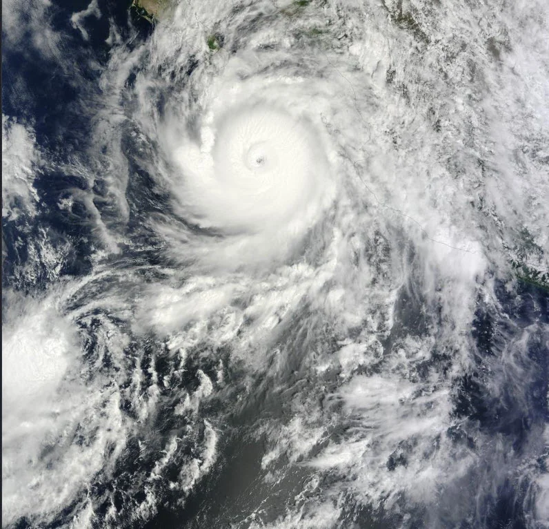
Hurricane Polo rapidly intensified into a powerful Category 4 hurricane off Mexico's Pacific coast early Tuesday, September 22, with maximum sustained winds reaching 130 mph (215 km/h) as forecasters warned that additional strengthening could make it a Category 5 storm.
The hurricane was centered about 330 miles (530 kilometers) south-southeast of Manzanillo, Mexico, and about 210 miles (340 kilometers) south of Zihuatanejo shortly after midnight local time. Polo was moving east-southeast at about 5 mph (7 km/h). The storm's core is currently forecast to remain offshore before turning northwest and tracking roughly parallel to southwestern Mexico, but coastal areas could still experience significant effects.
A Tropical Storm Watch is in effect along the Mexican coast from Tecpan de Galeana to Manzanillo. Tropical-storm conditions are possible within the watch area by early Wednesday. Polo is expected to produce 4 to 8 inches of rain, with isolated totals reaching 12 inches, across coastal portions of Guerrero and Michoacán through Thursday. Forecasters warned that the rainfall could cause life-threatening flooding and mudslides, particularly in steep terrain. Coastal portions of Oaxaca, Colima and Jalisco could receive 3 to 6 inches of rain.
Swells generated by Polo are also expected to affect southwestern Mexico during the next several days, creating potentially life-threatening surf and rip-current conditions. Hurricane-force winds extend up to about 30 miles (45 kilometers) from Polo's center, while tropical-storm-force winds extend outward as far as 80 miles (130 kilometers).
Polo's rapid strengthening remains ongoing, and forecasters say it could become a potentially catastrophic Category 5 hurricane Tuesday or Wednesday. Even if its center stays offshore, the storm's rainfall, surf and outer winds pose hazards along Mexico's southwestern coast.