Hurricane Polo surges to Category 5 off Mexico
Schools close as 165-mph storm threatens flooding and dangerous surf
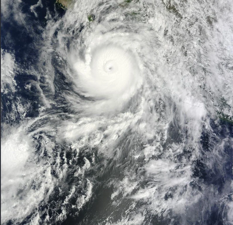
Hurricane Polo remained an extremely dangerous Category 5 hurricane early Wednesday after undergoing an extraordinary period of rapid intensification off Mexico's southwestern coast. At 12 a.m. CST Wednesday, the National Hurricane Center placed Polo about 200 miles south of Zihuatanejo, Mexico, with maximum sustained winds of 165 mph and a minimum central pressure of 905 millibars.
Polo became considerably stronger than the Category 4 storm with 130 mph winds reported a day earlier. At its peak Tuesday afternoon, NOAA Hurricane Hunters measured maximum sustained winds of 180 mph and a central pressure of 892 millibars. That pressure was the second-lowest recorded for an eastern Pacific hurricane, behind Hurricane Patricia in 2015. The NHC described Polo's intensification as "truly remarkable," saying its winds increased by roughly 90 knots in 24 hours. Forecasters said Polo encountered exceptionally warm ocean water, low wind shear and abundant atmospheric moisture, conditions highly favorable for rapid strengthening.
Mexican authorities are already taking precautions despite forecasts keeping Polo's core offshore. Michoacán suspended classes on September 22 and 23 at public and private schools in seven municipalities: Aquila, Coahuayana, Chinicuila, Coalcomán, Lázaro Cárdenas, Arteaga and Tumbiscatío. School activities were also suspended Wednesday in several regions of Guerrero, including areas around Acapulco and the Costa Grande and Costa Chica.
A Tropical Storm Warning is in effect from Tecpan de Galeana to Punta San Telmo. The NHC forecasts 3 to 6 inches of rain, with isolated totals reaching 8 inches, across coastal portions of Guerrero and Michoacán through Thursday, creating risks of life-threatening flooding and mudslides. Swells generated by Polo are also expected to produce dangerous surf and rip currents along portions of southwestern Mexico. Polo is forecast to remain a powerful major hurricane during the next several days, although fluctuations in intensity are possible.