Hurricane Rachel churns away from Mexico with 100 mph winds
Dangerous surf threatens Baja California coast through Monday
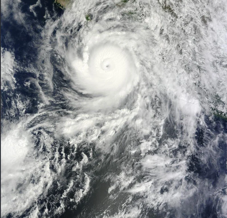
Hurricane Rachel remains a powerful storm in the eastern Pacific but is moving away from Mexico, reducing the threat of a direct landfall while continuing to generate dangerous ocean conditions along the Baja California Peninsula.
The National Hurricane Center reported early Monday, October 5, that Rachel had maximum sustained winds near 100 mph, down slightly from 105 mph Sunday afternoon. The storm was centered near 20.2°N, 114.8°W and moving west-northwest at about 7 mph. Rachel's hurricane-force winds extended as far as roughly 40 miles from its center, while tropical-storm-force winds reached much farther outward. Peak seas near the hurricane were estimated at about 32 feet.
Rachel strengthened to a Category 3 hurricane earlier in its lifespan, reaching winds of 120 mph, before weakening. Forecasters expect the hurricane to continue moving generally westward over the open Pacific and gradually weaken beginning Monday. There were no coastal watches or warnings in effect as of the latest advisories.
The storm is still affecting land through the ocean. The National Hurricane Center warned that swells generated by Rachel will continue reaching the Baja California Peninsula through Monday, producing potentially life-threatening surf and rip currents. Earlier in the storm, heavy rainfall and dangerous coastal conditions prompted precautions in parts of western Mexico, including Baja California Sur, Sinaloa and Jalisco.
Rachel is part of an unusually active stretch of Pacific tropical activity. Farther west, Nolo crossed the International Date Line on Sunday and transitioned from a hurricane to a typhoon, leaving Rachel as the hurricane still being tracked by the National Hurricane Center in the eastern Pacific.